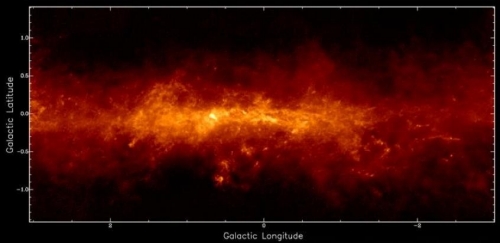
The APEX Telescope Large Area Survey of the Galaxy (ATLASGAL) is an imaging survey covering 420 square degrees of the inner Galactic Plane at a wavelength of 870μm.The current release consists of emission maps covering the full area surveyed, available as 9 square degree tiles.
Release of Emission Maps and Catalogues from the APEX ATLASGAL Survey

The ATLASGAL observations were carried out between 2007 and 2010, using the LABOCA bolometer array at the APEX Telescope. The current release consists of emission maps covering the full area surveyed, split into 3x3 degree tiles and available from the dedicated Phase 3 query interface. The noise level reached is typically 60 mJy/beam, with an angular resolution of 19 arcseconds. Another set of images, in which the LABOCA data have been combined with observations from the Planck satellite, in order to recover the most spatially extended emission, is also available.
In addition to the source catalogues associated to each image, a compact source catalogue extracted in a different way is provided and is searchable via the ESO Catalogue Facility. More information regarding this release is given in the accompanying release description.
Image credit: Csengeri et al. 2016, A&A, 585, A104
