Pahoittelumme! Tämä sivu ei ole vielä saatavilla haluamallasi kielellä, joten näytämme sen sijaan alkuperäisversion.
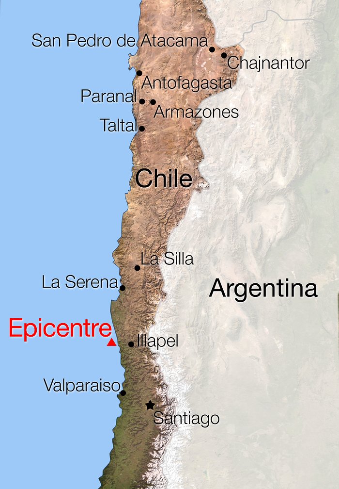
Map of Chile showing location of the earthquake of 16 September 2015
A magnitude 8.3 earthquake struck central Chile at about 20:00 local time on Wednesday 16 September 2015 (01:00 CEST on 17 September) between Santiago and La Serena, followed by several aftershocks. This map shows the location of the epicentre and the ESO Observatories in Chile. No casualties among ESO staff were reported and no major problems were reported from the ESO Sites.
Oikeudet:ESO
Kuvasta
| Tunnistus: | ann15067a |
| Tyyppi: | Kuvitus |
| Julkaisupäivä: | 17. syyskuuta 2015 15:00 |
| Vastaavat tiedotteet: | ann15067 |
| Koko: | 1764 x 2540 px |
Kohteesta
| Tyyppi: | Unspecified |
| Kategoria: | Illustrations |