Désolé ! Cette page n'est pas disponible dans la langue que vous avez choisie. Nous vous la proposons donc dans sa version originale
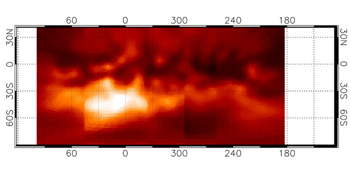
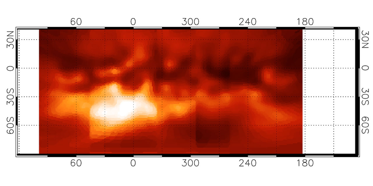
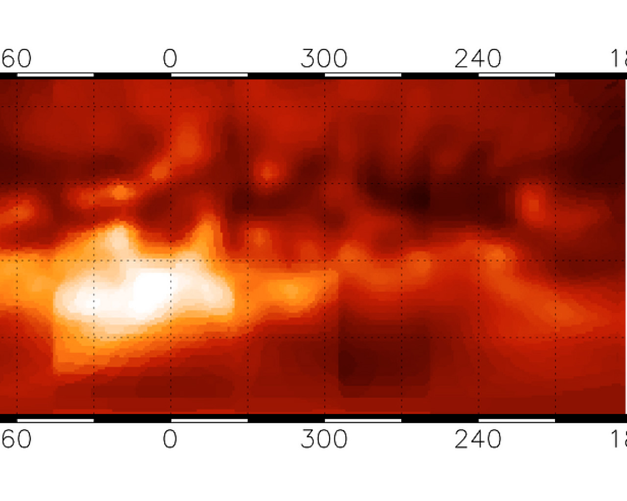
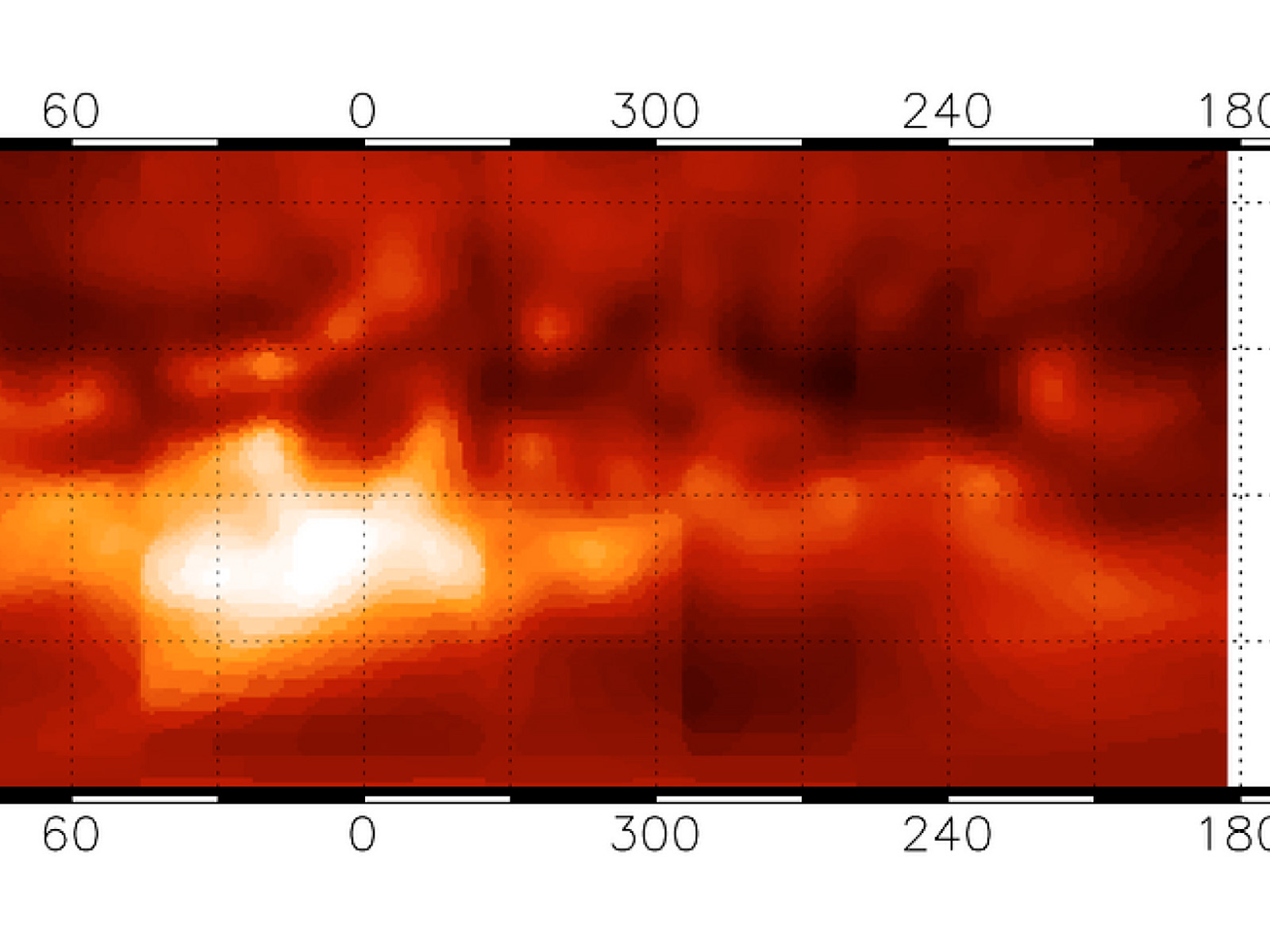
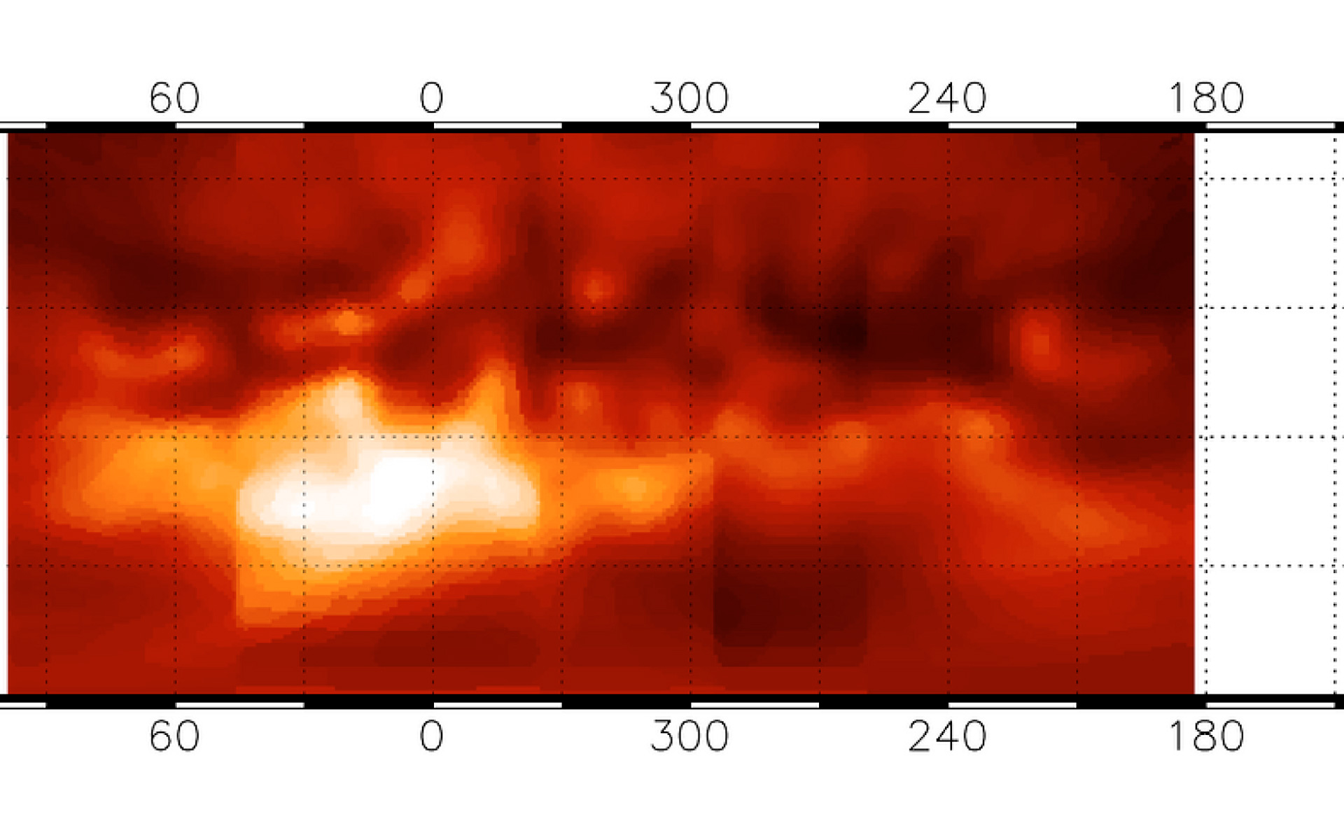
Map of Titan's surface features
Map of Titan's surface features. It was obtained through a "transparent", narrow spectral window with the 8.2-m VLT YEPUN telescope and the NACO adaptive optics instrument operated in the Simultaneous Differential Imager (SDI) mode. It covers about three-quarters of the full surface and has an image resolution (sharpness) of 0.06 arcsec, corresponding to 360 km on the surface. One degree of longitude on the equator corresponds to 45 km on Titan's surface. The brightness is proportional to the surface reflectivity. The nature of the various regions is still unknown although it is speculated that the darkest areas may indicate the extent of reservoirs of liquid hydrocarbons.
Crédit:ESO
À propos de l'image
| Identification: | eso0412a |
| Type: | Observation |
| Date de publication: | 14 avril 2004 |
| Communiqués de presse en rapport: | eso0412 |
| Taille: | 1920 x 805 px |
À propos de l'objet
| Nom: | Titan |
| Type: | Solar System : Planet : Satellite : Feature : Surface |
| Catégorie: | Solar System |
Formats des images
Fonds d'écran
Couleurs & filtres
| Domaine | Longueur d'onde | Télescope |
|---|---|---|
| Infrarouge Near-IR | 1.575 μm | Very Large Telescope NACO |