VLT SCIENCE PERFORMANCE
POINT-AHEAD METHOD FOR SEEING PREDICTION: PRINCIPLE
Because of the properties of "frozen turbulence", it is possible
to predict the observing conditions by observing low over
the horizon in the direction of the prevailing wind. The "time lag"
varies from a few minutes (low altitude layers) to a few tens of
minutes (tropopause).
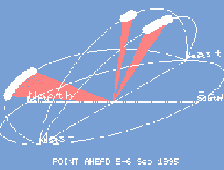
Experimental Verification
Comparison of simultaneous recording
of seeing at La Silla measured at Zenith and at 20 degrees above
northern horizon (detection of low altitude layers).
For this purpose,
two DIMM (Differential Image Motion Monitor) were operated side by side
on a 5 m high tower.
The intercorrelation function shows an average time lag of 20 minutes with a broadening of the correlation peak.
The wind velocity at ground level was between 2 and 3 m/s from the
direction NNE. Assuming a constant vertical profile for the
wind velocity, the corresponding point-ahead distance is 3 km.
For a 20 degrees elevation angle, the bulk of the turbulent would be at an altitude of 1000 m above the site level.
The low value of the intercorrelation function at lag 0 indicates a low level of turbulence travelling in the transverse (West-East) direction.
More measurements are planned for 1996, particularly from Paranal where high
altitude layers dominate.
ESO REVIEW 1996 ..................WP017..Astronomical Site Testing